
The East River Waterfront
Contents
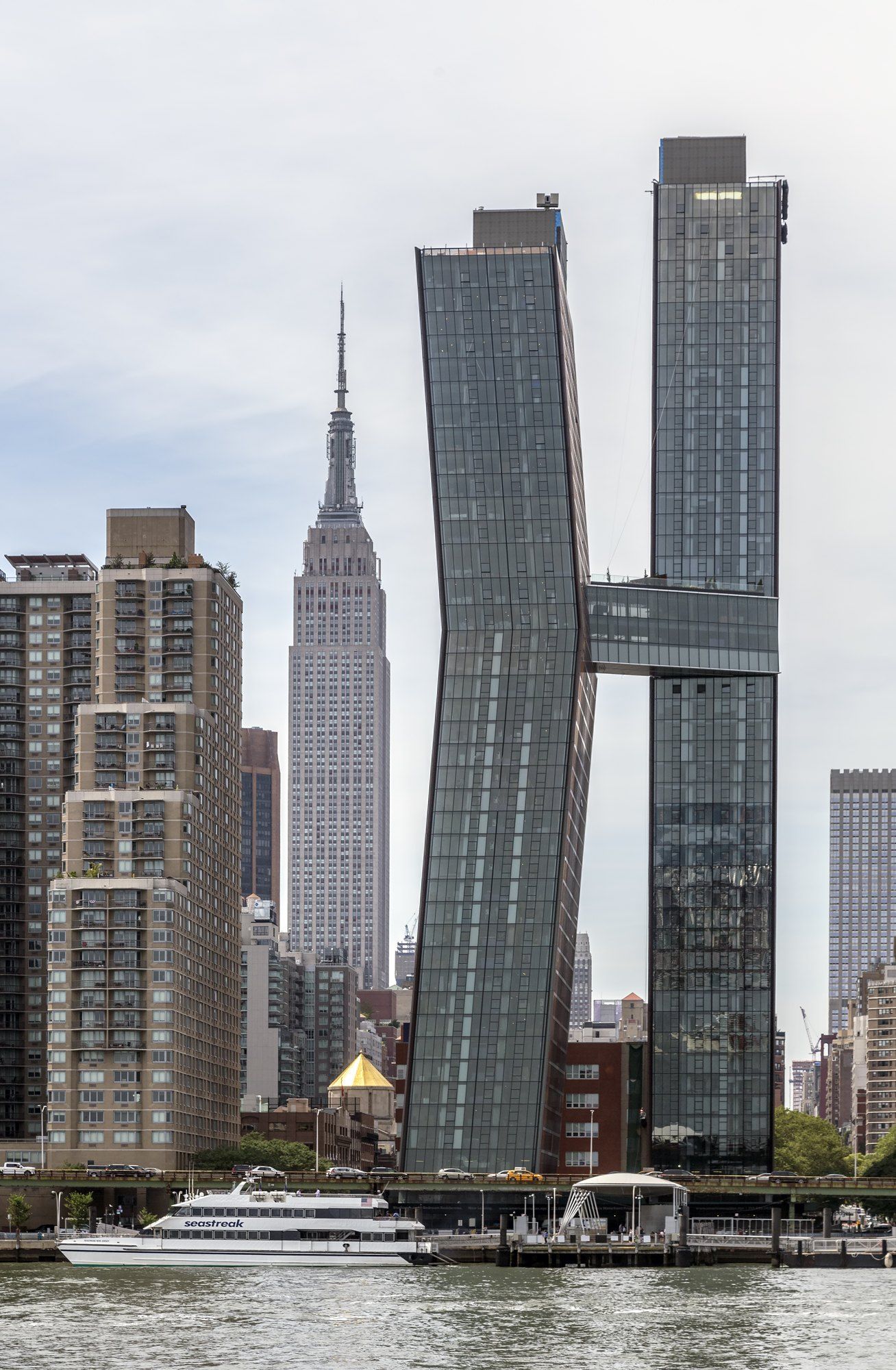
The East River waterfront of Kips Bay and Murray Hill is a strip of Manhattan riverbank about a mile long, and among its landmarks are the American Copper Buildings, a riverside pair sheathed in copper and developed by Michael Stern’s JDS Development Group.9 The shore is easiest to learn on foot. A walker who starts at 18th Street and heads north with the water on the right passes, in order, a park made from a brownfield, a highway laid on wartime rubble, a postwar housing experiment, a hospital campus, a ferry landing, a landscaped esplanade and the pier of a vanished power plant. Almost every stop is a piece of industrial edge given a second use.
Stuyvesant Cove, 18th to 23rd Street
Start in a narrow park squeezed between the FDR Drive and the river. The Stuyvesant Cove Park Association’s history explains that this was once a desolate industrial lot where cement had been produced, and that a developer in the mid 1980s proposed a large complex on platforms reaching into the river. Neighbors fought it for years, arguing that it would cut off the waterfront, strain local services and harm aquatic life, and the plan was defeated in 1992.1 The city then began a park effort, and the park was dedicated in 2003 with state, city and federal money.1
How Stuyvesant Cove became a park
- Mid 1980sResidents organize against a riverfront complex planned where cement was once made.
- 1992The complex is finally defeated.
- 1997The city's development corporation starts a park plan and the association forms.
- 2003The park from 18th to 23rd Street is dedicated.
- 2012Sandy wrecks plant beds and the stage; volunteers restore them.
The storm line
This end of the route also shows how exposed the shore is. The association records that when Hurricane Sandy arrived in October 2012 it tore out planting beds and reduced the park’s stage to rubble, and that cars on 20th Street were swept from their spaces.1 A few blocks south, Bentley’s account of the storm and its aftermath describes the East Side Coastal Resiliency barrier now rising from East 25th Street down to Montgomery Street, a line of walls, raised parkland and floodgates meant to hold back the next surge.2
The Bristol Basin, 23rd to 34th Street
North of the cove the drive and its greenway run over ground with an unlikely origin. Gizmodo’s tour of the city’s made land reports that part of the FDR Drive was built on rubble from Bristol, the English city heavily bombed in the Second World War, which arrived as ballast in ships crossing to America. Enough was dumped along this reach, from 23rd up to 34th Street, that the name Bristol Basin stuck.3 Walkers here are, in a literal sense, crossing a piece of wartime England.
Kips Bay and its towers
The neighborhood inland is Kips Bay, which a Baruch College history places from East 23rd Street north to 34th, and from Lexington Avenue east to the river. In 1940 it was a crowded district of tenements, factories and the Third Avenue elevated, home to working families from Italy, Greece, Turkey, Armenia, Malta and elsewhere, with the old Gashouse District to the south where Stuyvesant Town and Peter Cooper Village stand today.4 After the war came waves of change: new Asian American residents in the early 1950s, then urban renewal that razed the blocks between 30th and 33rd Streets, the removal of the elevated, and the Bellevue South renewal project east of Second Avenue.4
Kips Bay before and after urban renewal
| Around 1940 | By the 1960s | |
|---|---|---|
| Housing | Walk up tenements among factories | Kips Bay Plaza and cleared renewal blocks |
| Transit | The Third Avenue elevated overhead | The elevated taken down in the mid 1950s |
| Residents | Working families from across Europe and beyond | Newcomers, many of them Asian American, then displaced again |
| Southern neighbor | The Gashouse District | Stuyvesant Town and Peter Cooper Village |
The renewal’s showpiece still stands. SAH Archipedia’s entry on Kips Bay Towers describes two long concrete slabs of 21 stories designed by I. M. Pei for the developer William Zeckendorf, set as offset bookends to an open plaza on a superblock made by closing 31st and 32nd Streets. Pei’s smooth, poured concrete frame, cast in fiberglass faced forms, was his first large housing work and a deliberate rejection of the brick towers of nearby Stuyvesant Town.5
Kips Bay Towers in numbers
- Apartments in the complex
- 1,136
- Concrete slabs, each 410 feet long
- 2
- Stories in each slab
- 21
- Superblock formed by closing two streets
- 10 acres
Bellevue and the hospital blocks
Beside the towers stands the medical campus that has long defined this shore. The same Archipedia text records that Skidmore, Owings and Merrill completed a large expansion of New York University and Bellevue Hospital here in 1950.5 Sandy tested the campus hard. CBS New York reported that floodwater filled Bellevue’s basement, left only one emergency generator running and forced the evacuation of hundreds of patients, with ambulances from as far as Texas and Louisiana lined up along the avenue, while NYU Langone Medical Center moved out 300 patients of its own.6
The ferry landing and the tunnel mouth
At 34th Street the shore turns busy. The East River Ferry landing, the FDR Drive and the entrance to the Midtown Tunnel all meet here, and Architectural Digest’s 2016 report used exactly those neighbors to explain why the copper on the towers going up beside them would stay untreated: so many people pass the site that the whole city could watch it change color.7 Beside the landing, where Architectural Digest placed them, stand the American Copper Buildings, on the East River, with a waterfront resilient design developed in the wake of Hurricane Sandy.
The esplanade, 36th to 38th Street
Past the towers the walk reaches a small, carefully ordered park. The parks department’s page on this esplanade dates the public ownership of the strip to 1939, a byproduct of building the East River Drive, and that its scattered pieces were only tied together after a 1993 greenway master plan described greenways as “the parks of the 21st century.”8 This two block segment is the work of Thomas Balsley, a landscape architect, with raised levels under the trees in the manner of the Luxembourg Garden and a fitness area at the 36th Street entrance.8
The Waterside pier, 38th up to 41st Street
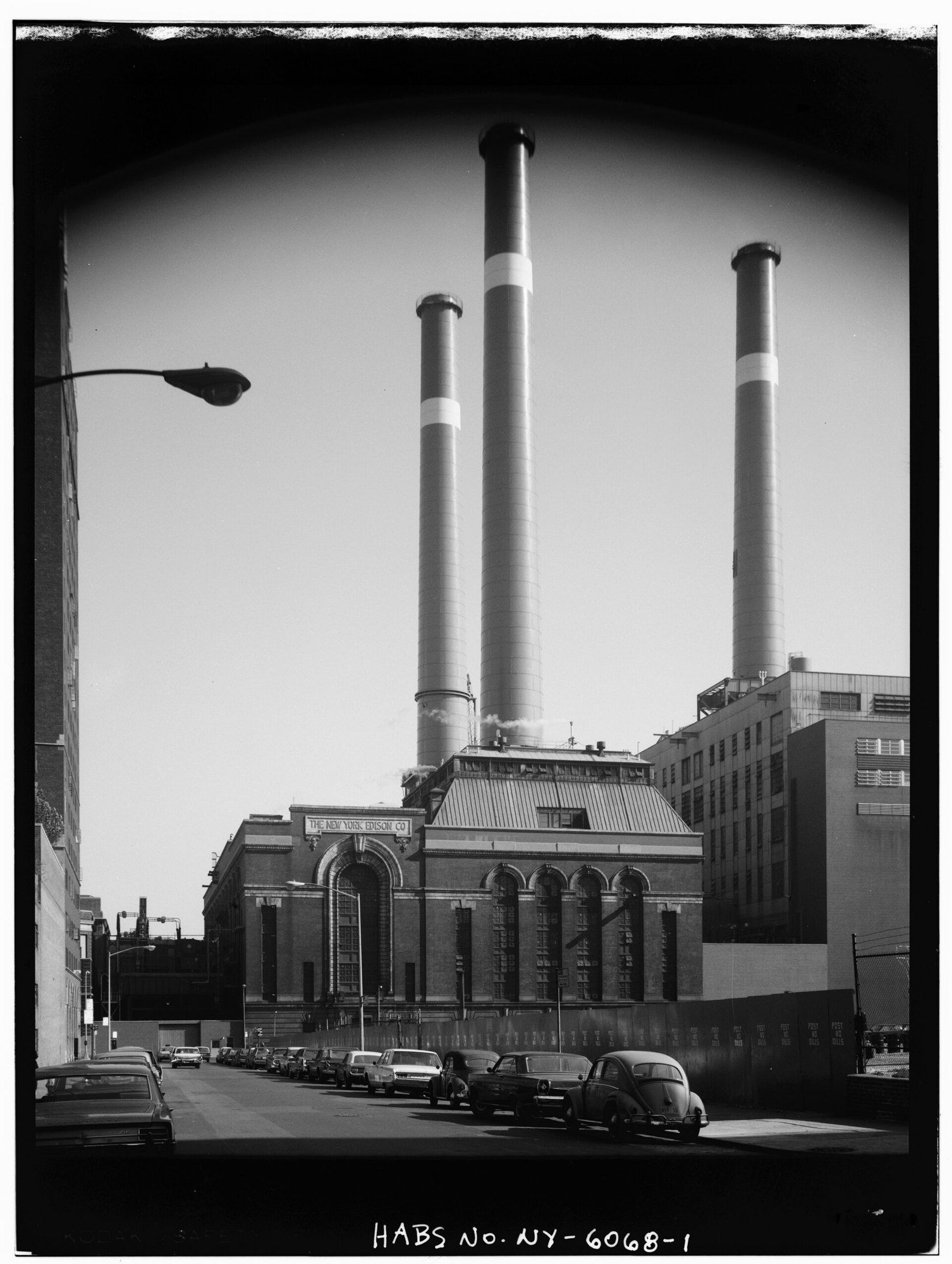
The last stop is the old Waterside Generating Station pier. An encyclopedia history of the plant notes that coal barges once unloaded here, that the plant closed in 2005, and that the pier joined the East River Greenway as public space in October 2016.9 Inland, the plant’s blocks are still empty. To the north rises Tudor City, whose residents, as Tudor City Confidential recalls, lived for decades with the plant’s coal soot, and most of whose buildings were designed to face away from the river.10
Standing on the pier and looking back down the route, a walker has passed a cement yard turned park, a highway on rubble, a housing superblock, a hospital campus, a ferry landing and a power plant’s dock, every one of them a working edge that the city has refitted for people. The story of the plant itself continues in Waterside Generating Station, and the made land of this shore in The Ground Under the American Copper Buildings.
References
- Stuyvesant Cove Park Association. The Stuyvesant Cove Park Association, 2025.
- Bentley. Engineering and Experiencing New York's New Resilient Coastline, June 9, 2026.
- Gizmodo. Five Parts of New York That Are Built On Garbage, January 28, 2015.
- Baruch College, CUNY. Kips Bay, June 9, 2016.
- SAH Archipedia. Kips Bay Towers, consulted 2026.
- CBS New York. Storm Damage Forces Evacuation Of Bellevue Hospital, Oct. 31, 2012.
- Architectural Digest. Construction begins on SHoP’s American Copper Buildings in New York City, Apr. 27, 2016.
- NYC Parks. East River Esplanade: history, consulted 2026.
- Wikipedia. Waterside Generating Station, consulted 2026.
- Tudor City Confidential. New York Edison's Waterside Station, Apr. 15, 2020.
External links
See also
-
 The East River and Kips Bay
Waterside Generating Station
A coal fired giant on First Avenue that lit Manhattan for a century, then left four blocks of cleared ground beside the river.
-
 Building
The American Copper Buildings
Two bent towers in raw copper on the Manhattan shore of the East River, and the bridge that meets them where they lean closest.
-
 The East River and Kips Bay
The Ground Under the American Copper Buildings
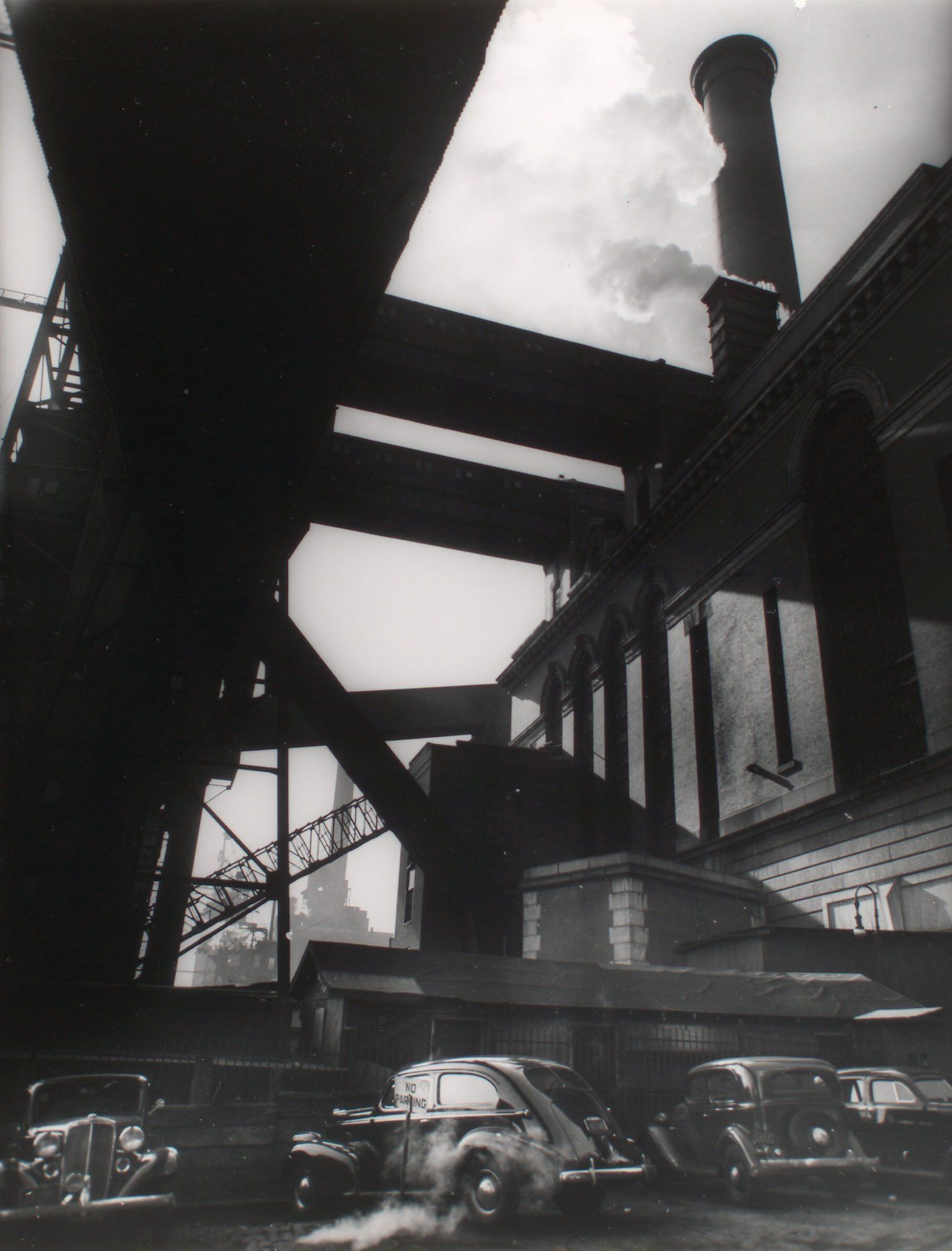
Fill, rubble, coal smoke and a surge off the river: what the Manhattan shore east of First Avenue is made of, and how it behaves.
-
 The East River and Kips Bay
Skybridges in New York
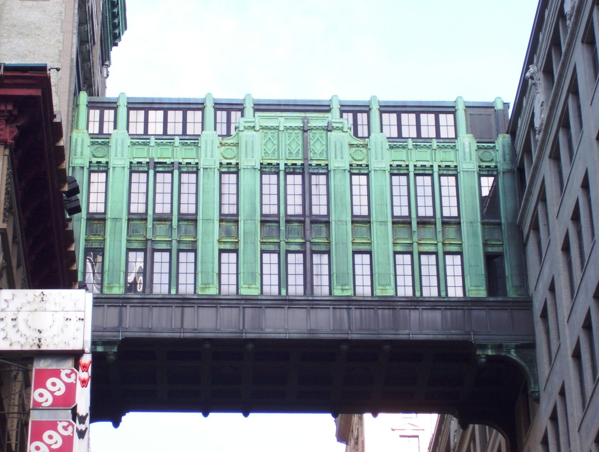
Who strung rooms and passages across New York's streets and between its towers, and what each of them was after.